


FLOOD MAPS & PHOTOS
Click here to return to previous page

Flooding in Valley Springs
Cosgrove Creek and Spring Valley Creek are subject to flooding. On this page you will find small maps that show properties located in the flood plain, info about FEMA and flood plain maps, and photos of local flooding.
New FEMA Flood Maps
The Federal Emergency Management Agency (FEMA) has recently revised its flood maps for Calaveras County. FEMA’s new flood maps show that various parcels throughout the county, including Mountain Ranch, Vallecito, and Valley Springs, are now partially or fully located within a designated flood hazard area. To view any scheduled meetings with FEMA and Calaveras County, visit our Special Meetings and Events page.
News Flash—new FEMA flood hazard maps available
New maps are posted on the County Planning Department webpage (look under Announcements-'Changes to FEMA floodmaps for Calaveras County'): Maps of new FEMA Floodzones in Calaveras County
Flood Plain Maps of Cosgrove Creek Flood Zone
Flood plain maps are available on the county website Flood Zone Locator. Note: maps may not reflect all new FEMA flood zones. Contact the county Building Dept. or Dave Pastizzo, County Flood Coordinator, at (209) 754-6394, for more specific information.
...............................................................
Below, Valley Springs center is at the top of the map; Silver Rapids Rd is toward the bottom. The yellowish shaded areas indicate parcels that have been designated as 'at risk' for flooding: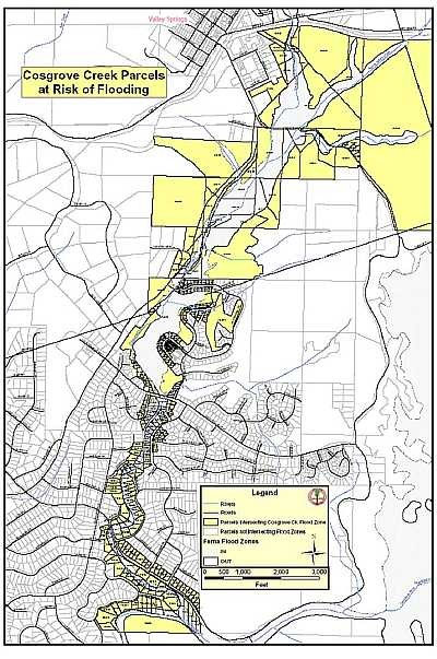
...............................................................
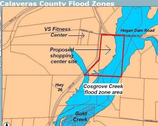
This map shows areas of development in known flood areas. Notice Gold Creek Estates at the bottom of the picture. Also notice the 'proposed shopping center':
...............................................................
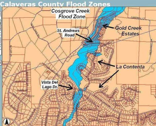
More Development in Flood Zone - Gold Creek and La Contenta.
Each tiny square indicates a parcel with a house on it:
...............................................................
A Closer Look at La Contenta and Gold Creek Estates.
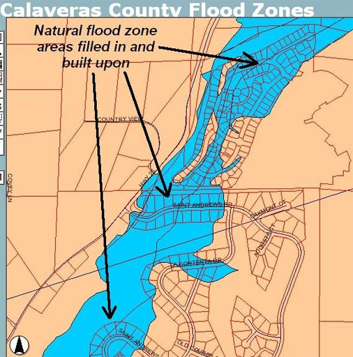
When a flood plain is filled, the water still has to go somewhere. Filling a flood plain only diverts the flood to another area or increases the velocity of flow in the channel:
...............................................................
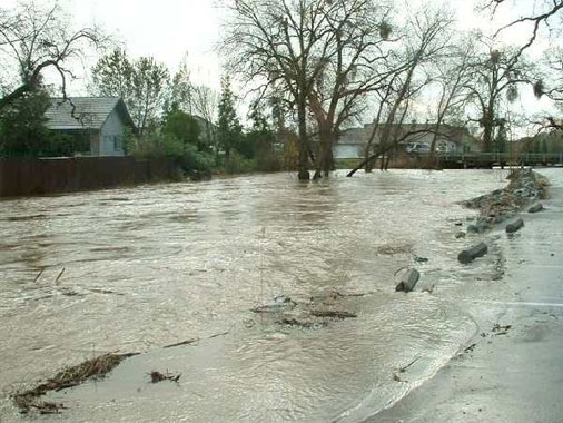
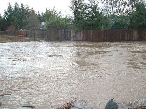
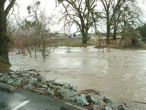
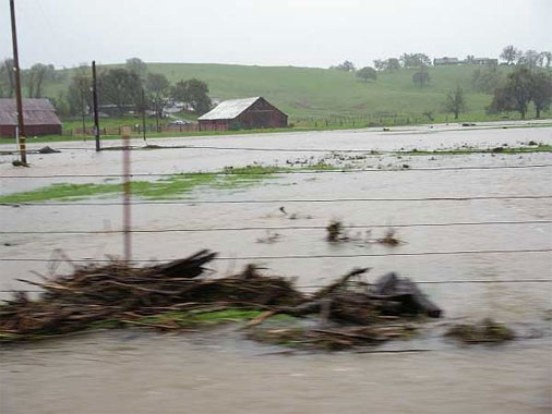
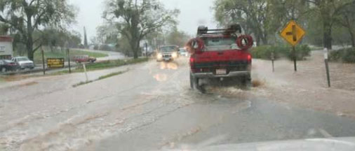
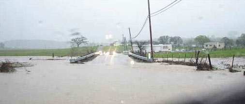
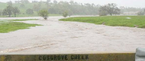
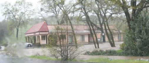
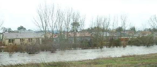
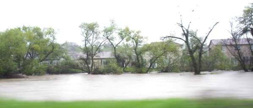
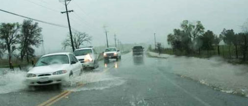
Photos of Cosgrove Creek Flooding
Photos below were taken April 2006 in the vicinity of La Contenta, Hwy. 26, Gold Creek Estates, and Hogan Dam Road:

HOME
About Us
Support & Action
Planning
Current Development
What's Happening
Resources & Links
Contact Us